High-Quality 3D Modeling Services for Landscape Projects
Bring rough designs to life with 3D modeling & 3D mapping services for landscape projects and education.
McNaught Design specializes in 3D modeling and landscape rendering, combining technical expertise with our outdoor-focused mission to support organizations in bringing their visions to life.
What Is 3D Modeling for Landscapes?
3D modeling for landscapes is a specialized field that focuses on digitally recreating natural environments. Unlike buildings and man-made structures, which follow straight lines and predictable geometry, landscapes are inherently complex, featuring varied terrain, natural features, and dense vegetation, making them more challenging to model accurately.
At McNaught Design, we bridge this gap by combining cartography, GIS, advanced 3D modeling software, and 3D scanning technology to bring even the most intricate landscapes into detailed, data rich 3D models. Our expertise ensures that natural environments are captured with both accuracy and visual clarity, making them ideal for planning, analysis, and immersive presentations.
Our 3D Modeling Services
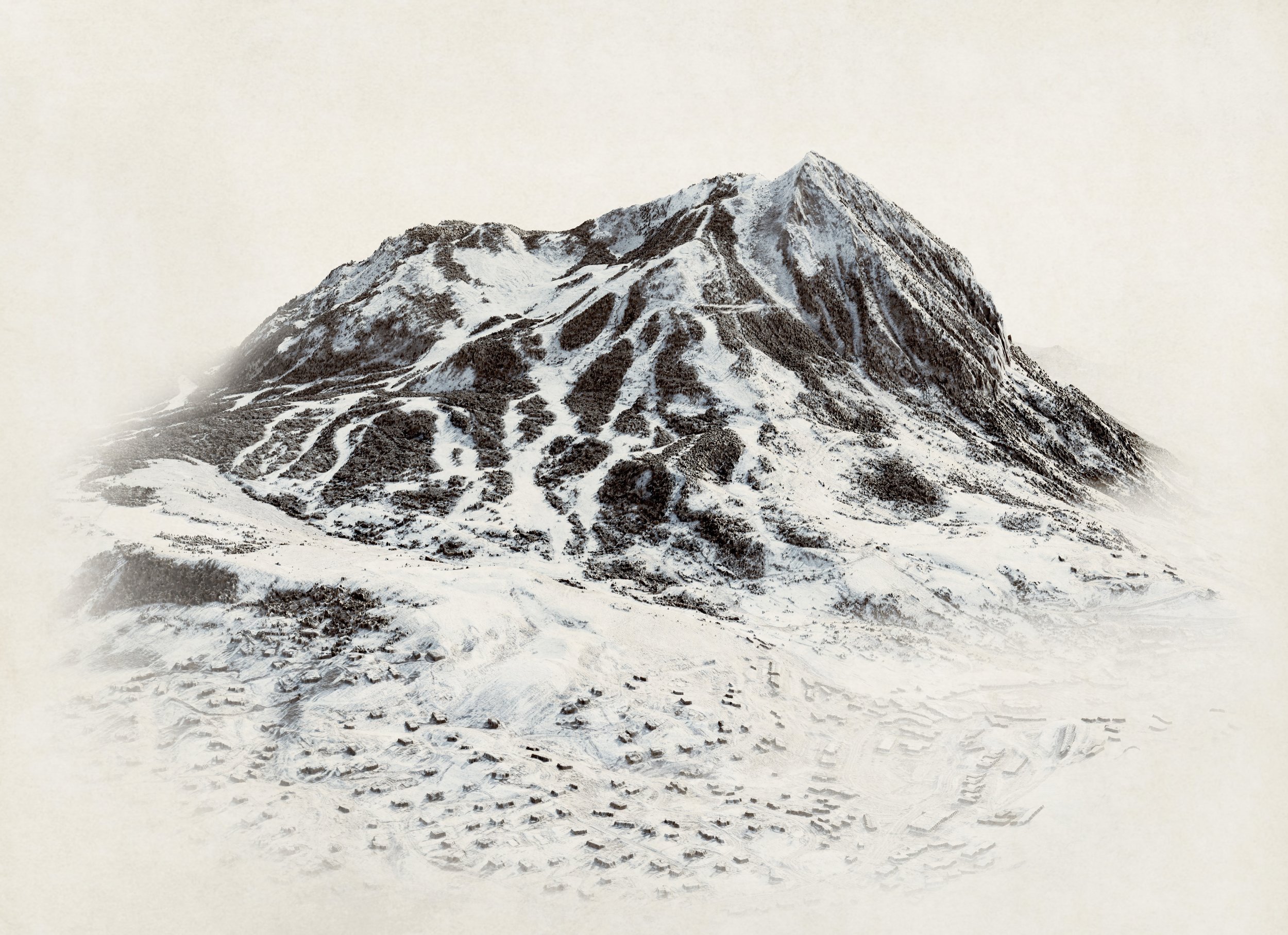
Hyper Realistic Terrain Modeling
We use GIS and topographic maps to lay the foundation for highly detailed 3D models of mountains, lakes, valleys, parks, and more. By integrating this data with advanced 3D software, we create hyper realistic 3D models and maps that accurately represent real world landscapes with precision and depth.
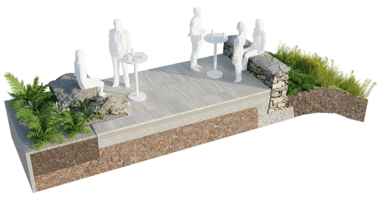
3D Cross Section Modeling
Designs can become complex quickly, and sometimes the best way to communicate an idea to a client or funder is through a 3D model. Simply provide us with a detail or sketch, and we'll handle the rest. Our realistic 3D section visualizations help bring your concepts to life, making it easier to convey your design intent.
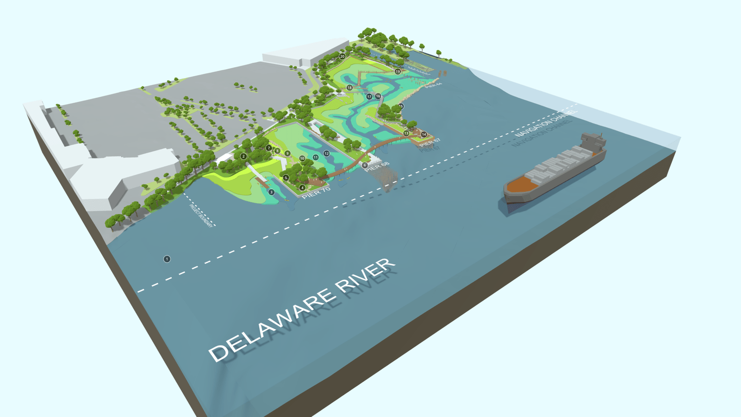
Interactive 3D Landscape Models
Sometimes, static models aren't enough to fully capture a design's potential. That's where our interactive 3D models truly shine. We model, render, and deliver an engaging, interactive experience that allows you and your clients to explore the design at their own pace. With clickable annotations and the ability to navigate the space, our interactive 3D models provide a dynamic and immersive way to understand your project.
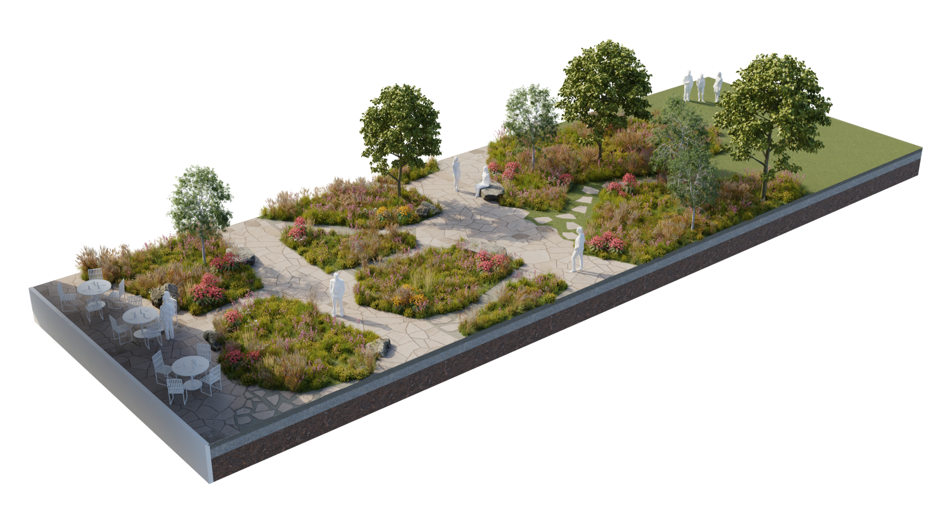
Design & Planning Visualization
With a strong foundation in landscape architecture and 3D modeling, McNaught Design specializes in creating detailed, accurate models of parks, gardens, urban streetscapes, and natural areas. By integrating 2D drafting with 3D modeling software, we produce high quality 3D renderings for projects of all sizes.

Why Choose McNaught Design for 3D Landscape Modeling?
Modeling living landscapes is a challenging task. With the intricacies of vegetation, terrain, and natural features, capturing the full complexity of landscapes in 3D requires a variety of specialized tools. McNaught Design is uniquely equipped to tackle this challenge, using industry standard techniques, advanced 3D mapping, drone scanning, and a few expert tricks. We excel at creating detailed 3D landscape design renderings and accurate 3D maps that bring natural environments to life.
Let us help enhance your project with our expert 3D services for landscapes, tailored to meet the specific needs of your vision.
Frequently Asked 3D Questions
-
We customize our 3D workflow and solutions to meet the specific needs of each deliverable. Our 3D map models are created using GIS data and advanced 3D software, ensuring precision and accuracy. For landscape renderings, we may begin with a 2D drafted sketch and transform it into a 3D model by building polygons from the ground up. In other cases, we utilize 3D scanning technology to capture an object, then process the data in 3D software to create a clean, detailed 3D mesh. This flexible approach allows us to deliver the most effective solution for your project’s requirements.
-
Our pricing for 3D landscape modeling is determined by the complexity and scope of the project. Please don't hesitate to contact us with details about your project, and we would be happy to provide you with a free, customized quote.
-
3D scanning is a process that captures the physical characteristics of an object or environment and converts them into a digital 3D model. Using specialized scanners (such as drones equipped with LiDAR or photogrammetry), 3D scanning collects detailed data points from the surface of the scanned object or landscape. This data is then processed into a highly accurate, digital representation of the real world object or site.
In landscape design, 3D scanning is particularly useful for capturing complex terrains, natural features, and large outdoor spaces with high precision. It enables designers to work with real world data, ensuring that every element of a project is accounted for, from the topography to the vegetation.

Contact us
Expert 3D Map Creators & Landscape Modeling Pros
Whether you need 3D modeling of natural landscapes, landscape design renderings, or interactive 3D models, we have your 3D project covered.
info@mcnaughtdesign.com


