Field Data Mapping Services for Smarter Decisions
Field mapping and GPS tracking services for conservation, trail design, and park planning.
McNaught Design blends a unique mix of conservation, wilderness navigation, drone technology, GIS, and GPS skills to provide high quality data collection for natural areas through Pennsylvania and surroundings.
What is Field Data Mapping?
Field data mapping is the process of collecting, analyzing, and visualizing spatial data to better understand landscapes, environments, and project sites. Using advanced drone technology, GPS, and GIS software, McNaught Design creates highly detailed, accurate maps that support planning, conservation, and design efforts. Whether mapping a park, development site, or historic property, our field mapping services provide the insights needed for better decision-making and impactful design.

Why Field Mapping Matters
Our field mapping is often combined with our cartography or drone services, but it also has uses on its own. We are here to discuss your unique project and see if field data mapping is right for you.
Locate Key Features
On the ground GPS tracking is essential for capturing the location of property characteristics that are not publicly available through online GIS portals. By capturing real-world spatial data using drones, GPS, and GIS technology, McNaught Design provides precise, up-to-date maps that help designers, planners, and conservationists understand their sites in greater detail.
Landscape Monitoring
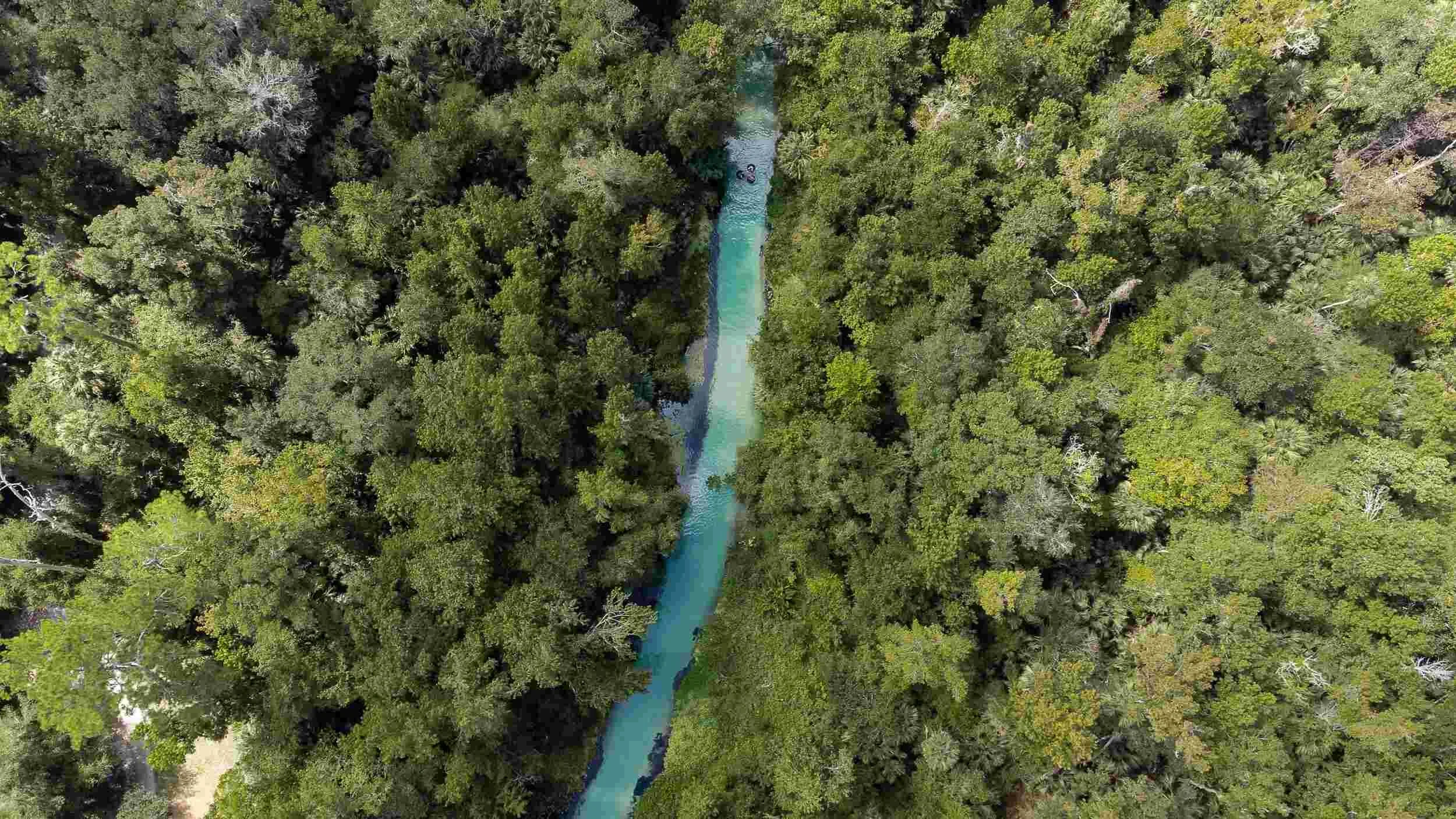
Field mapping helps track changes in landscapes over time, making it an invaluable tool for conservation efforts. By using drone imagery and GIS analysis, we can monitor forest health, erosion, waterway conditions, and habitat changes. This data supports ecological restoration projects, informs land-use policies, and helps organizations protect sensitive ecosystems from urban expansion and climate change.
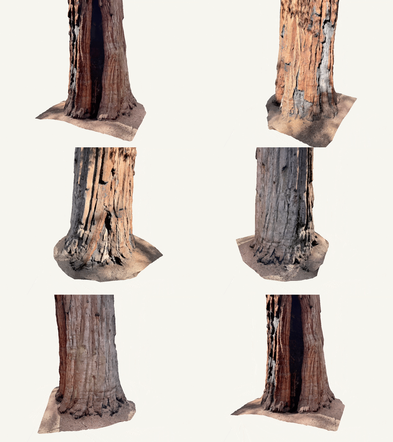
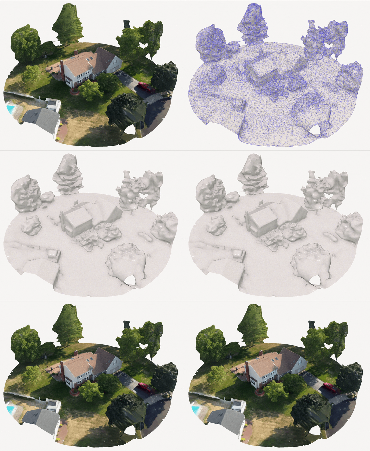
By integrating 3D scanning with field data mapping, McNaught Design takes site analysis to the next level. Using drone-based photogrammetry and GIS technology, we create highly detailed, three-dimensional models that accurately represent landscapes, structures, and terrain.
This combination allows for:
Hyper-accurate topographic mapping – Capturing elevation changes, slopes, and landforms with precision.
Detailed site documentation – Preserving historic sites, monitoring construction progress, or tracking environmental changes over time.
Enhanced planning and visualization – Providing architects, planners, and conservationists with realistic, data-driven 3D models to guide design decisions.
Improved decision-making – Reducing costly errors by working with real-world site conditions in 3D.
By merging 3D scanning with field mapping, we transform complex spatial data into actionable insights, allowing clients to make better, faster, and more informed decisions.
Combining 3D Scanning with Field Data Mapping

Why Choose McNaught Design for Field Data Mapping?
At McNaught Design, we bring a unique combination of public park design expertise, conservation experience, and advanced drone technology to every mapping project. With a background in large scale park and landscape planning, we understand the complexity of designing and managing outdoor spaces whether it’s a historic site, nature preserve, or urban park.
Our expertise in cartography and GIS mapping allows us to create detailed, data rich maps that go beyond simple aerial imagery. We specialize in recording and visualizing complex sites, using drone-based aerial surveys, 3D scanning, and field mapping to ensure every detail is captured with precision.
Additionally, our experience with wilderness navigation and outdoor leadership training means we can efficiently map remote and challenging terrains. Whether documenting ecological features, historic landmarks, or planning new public spaces, we provide accurate, visually compelling maps that support better decision making, conservation efforts, and long-term site management.
By choosing McNaught Design, you’re working with a team that understands landscapes from both a technical and ecological perspective, ensuring that every project is mapped with clarity, accuracy, and with a deep respect for the environment.
Industries Served
McNaught Design works with companies, organizations, and individuals from many different industries, including:
National & State Parks
Local Parks & Recreation
Adventure Tourism
Gardens & Arboretums
Historic Properties & Landmarks
Conservation & Nature Preserves
Urban Planning
Events & Navigation
Frequently Asked Questions
-
In many cases, publicly available data for a property is limited or nonexistent, requiring the creation of accurate site information from the ground up. The most reliable way to obtain precise data is through on-site field mapping and 3D scanning.
For example, if a site contains historic ruins obscured by dense tree cover, traditional aerial imagery may fail to capture their presence. In such cases, conducting an in-person site survey allows us to accurately document their location and structure. Utilizing 3D scanning technology, we can create detailed digital models to support historic preservation, planning, and research, ensuring these valuable features are thoroughly recorded and analyzed.
-
The outcome of a field mapping session depends on the specific project needs. If the goal is to create a map for print or web, the final deliverable will be a high-quality, visually refined map.
However, if the collected data is intended for ongoing analysis and GIS integration, we can provide industry standard file formats, including SHP, KML, KMZ, GPX, and GeoTIFF. These formats ensure compatibility with GIS software, spatial analysis tools, and future project developments, allowing for seamless data utilization and decision-making.
-
While it is not necessary for you to be on site during field data collection, it is preferred. Being part of the process allows you to point out key features you want recorded especially on larger sites. If you cannot be present, we ask for a complete list of features to be captured and their relative locations 48 hours before the GPS data collection date.

Contact us.
Not sure if you need field data mapping or GPS tracking for your project? We are happy to talk through the project with you and see if field data collection is right for you.
info@mcnaughtdesign.com


