
Cartography & Custom Map Design Services
Connecting people with parks, trails, and public lands through beautiful maps, graphics, and aerial imagery.
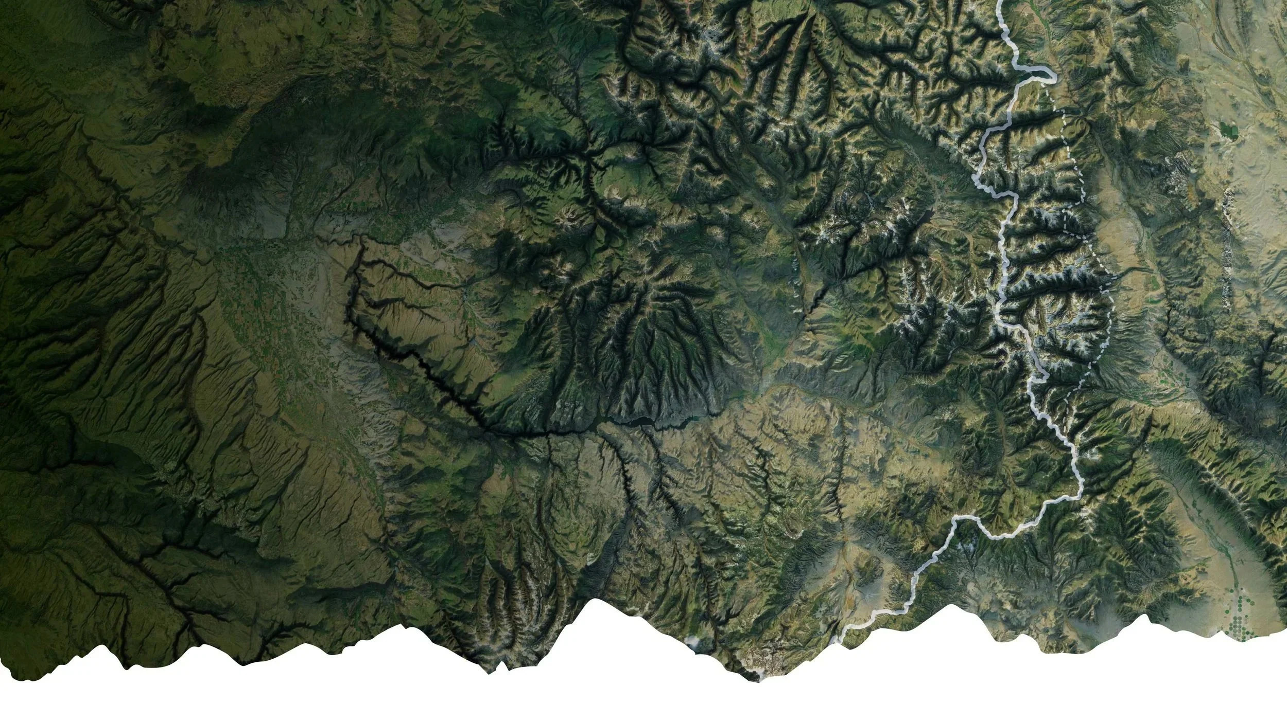
Mapping
Professional map design and GPS services for web and print. We create detailed, compelling maps for trails, parks, and visitor centers, optimized for both digital platforms and high-quality print production.

Aerial Data
FAA-certified aerial imagery, drone videography, and 3D scanning services for tourism, recreation, and visualization. We capture stunning high-resolution aerial photography and video that showcases destinations, properties, and landscapes.

Trail Graphics
Expert graphic design and 3D modeling services that bring landscapes and outdoor experiences to life. From trail signs and visitor guides to immersive landscape visualizations, we create compelling visuals that engage viewers.
Our Mission
At McNaught Design our mission is to support organizations that connect people with nature through the design of beautiful maps, graphics, and aerial imagery.
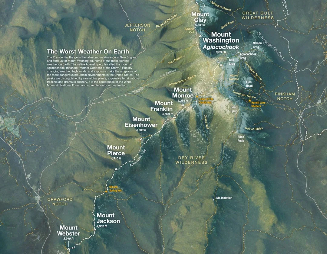
Cartography
We create custom maps that bring projects to life. Whether for parks, trails, or public lands, our maps blend clear communication with beautiful graphics. From printed trail maps to interactive digital maps, every project is tailored to meet your goals.
Aerial Imagery
Looking for drone services in Philadelphia or surroundings? We provide 4K video, 3D scanning, and stunning photography for projects of all sizes. Hire a drone pilot to make your project stand out!
Graphic Design
Bring your mission to life with bold, nature informed graphic design that inspire action, support fundraising, and elevate every outdoor experience.

3D Landscape Modeling
With a background in landscape architecture, McNaught Design offers professional 3D modeling services that blend photogrammetry and modeling to make unique graphics that speak for themselves.

Field Data Mapping
Get accurate GPS field data collection for GIS projects, trail networks, habitat assessments, historic preservation, or conservation monitoring.
The Print Shop
Looking for map prints? Check out the latest topographic maps of your favorite places around the world at Snowbelt Studio, McNaught Design’s exclusive print shop.
Offering Industry Specific Solutions

-
We provide high-resolution aerial mapping, site analysis, and custom map design to help parks and recreation departments plan, develop, and maintain green spaces. Our services support trail mapping, facility planning, and ecological assessments, ensuring sustainable and accessible outdoor environments.
-
Our precision drone services and map design solutions offer architects and designers detailed site surveys, 3D modeling, and visual renderings. By integrating aerial imagery with mapping data, we provide accurate topographic insights that enhance planning and presentations.
-
We use drone technology and custom mapping to monitor ecosystems, track environmental changes, and assess land conditions. Our mapping services support habitat restoration, erosion control, and long-term conservation planning with visually rich, data-driven maps.
-
We create custom maps and breathtaking aerial imagery to enhance tourism marketing, wayfinding, and visitor experiences. From scenic routes to heritage sites, our maps and visuals help tourism boards, parks, and attractions showcase destinations in an engaging and informative way.
-
We create compelling aerial photography, video content, and custom property maps to showcase real estate developments, large estates, and landscapes. Our detailed mapping services help highlight property assets, terrain features, and user way finding.
-
From botanical gardens to nature preserves, we provide aerial imagery, map design, and landscape analysis that assist in management, visitor experience planning, and plant health monitoring. Our custom maps help caretakers document and preserve these vital spaces.
-
Our drone technology and historical site mapping help document and assess historic landscapes and structures with precision. We create detailed maps and 3D models to aid in restoration, preservation planning, and long-term site monitoring.
-
We provide essential data for urban and landscape planning with advanced aerial surveys, map design, and progress tracking for infrastructure and development projects. Our mapping services improve site analysis, zoning studies, and overall decision-making.
Project Highlights
Learn more about some of our favorite projects, from trail maps to historic properties and more.

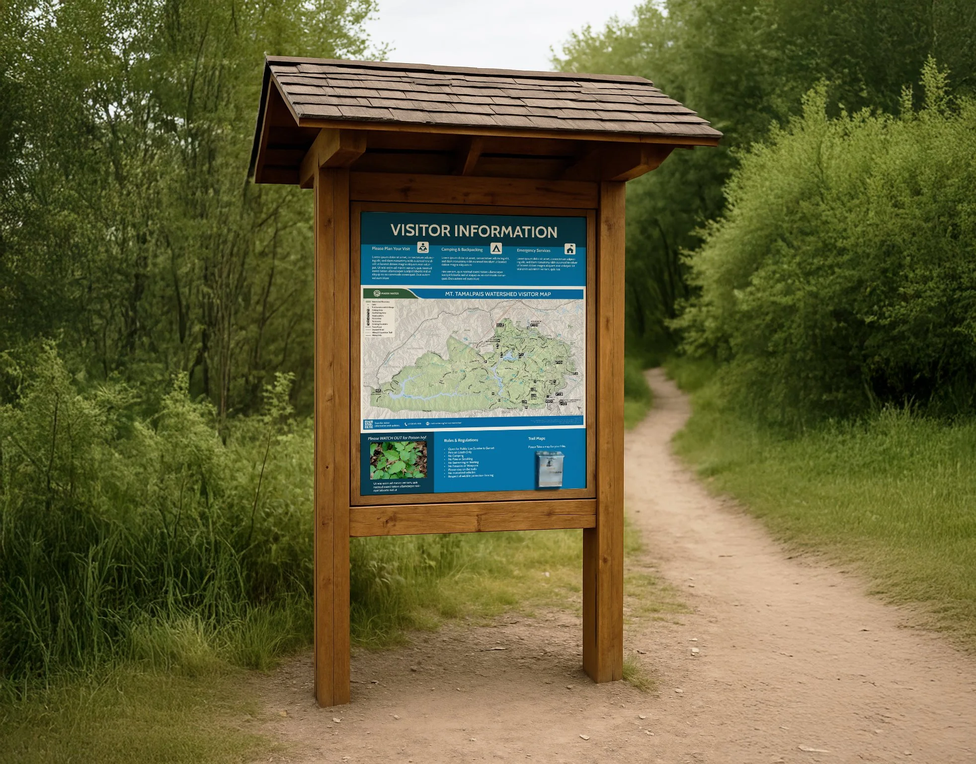
Mt. Tamalpais Watershed Trail Map
The Mt Tamalpais Watershed Trail Map Redesign brings new life to the area’s popular hiking and equestrian trails.
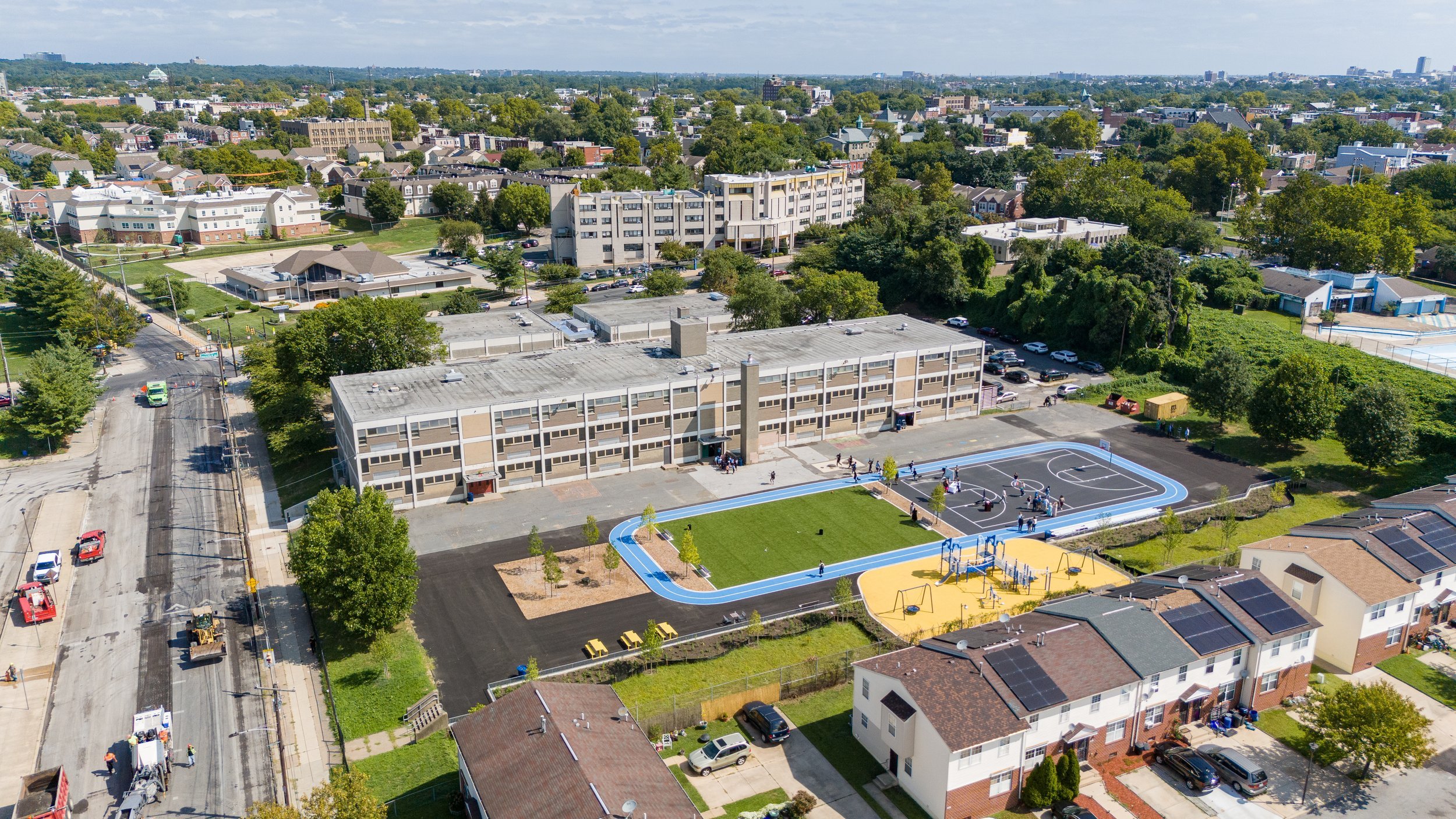
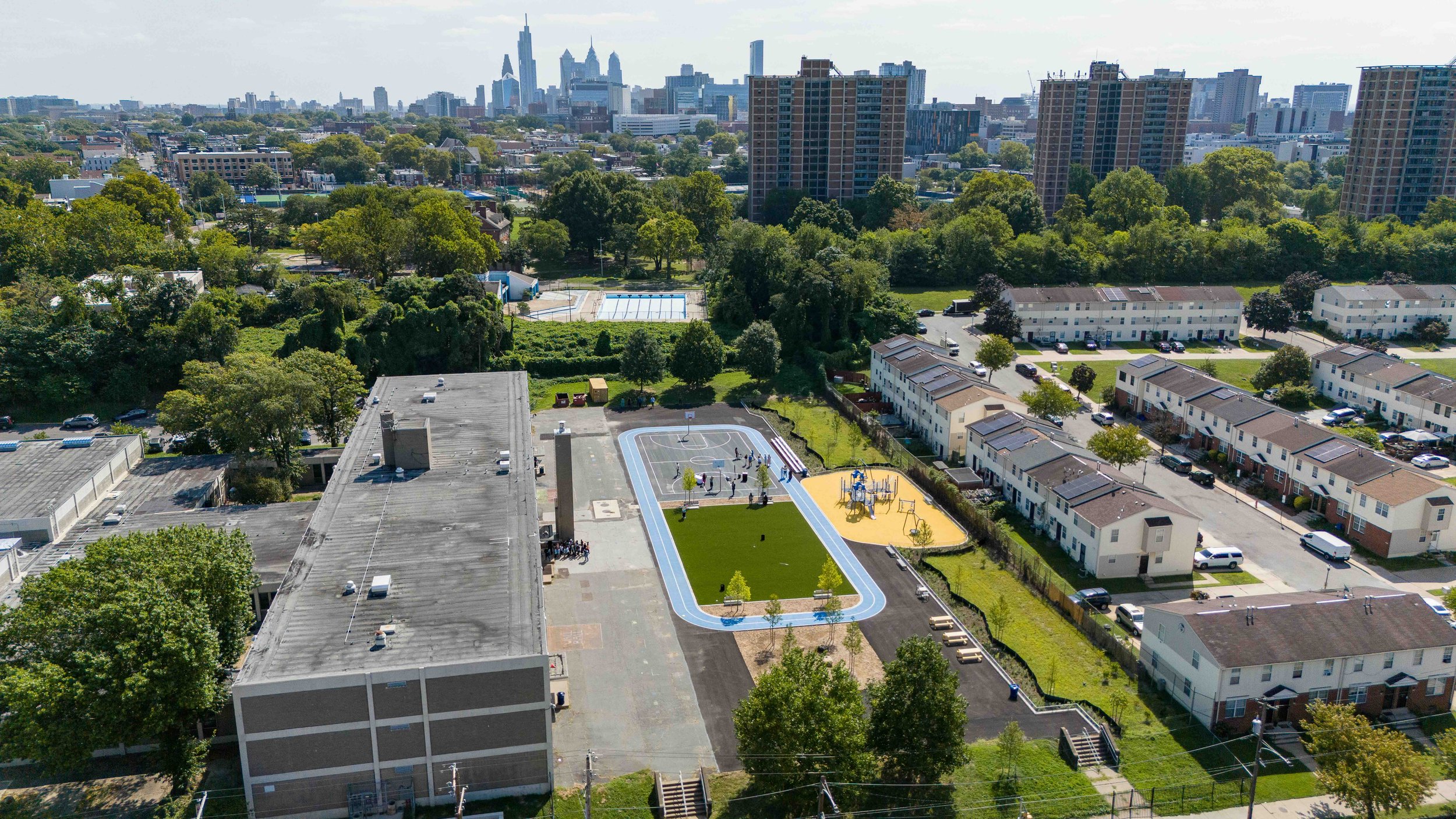
Alain Locke Schoolyard
OLIN and The Trust for Public Land designed a new playground for the Alian Locke School in Philadelphia. McNaught Design filmed the grand opening.
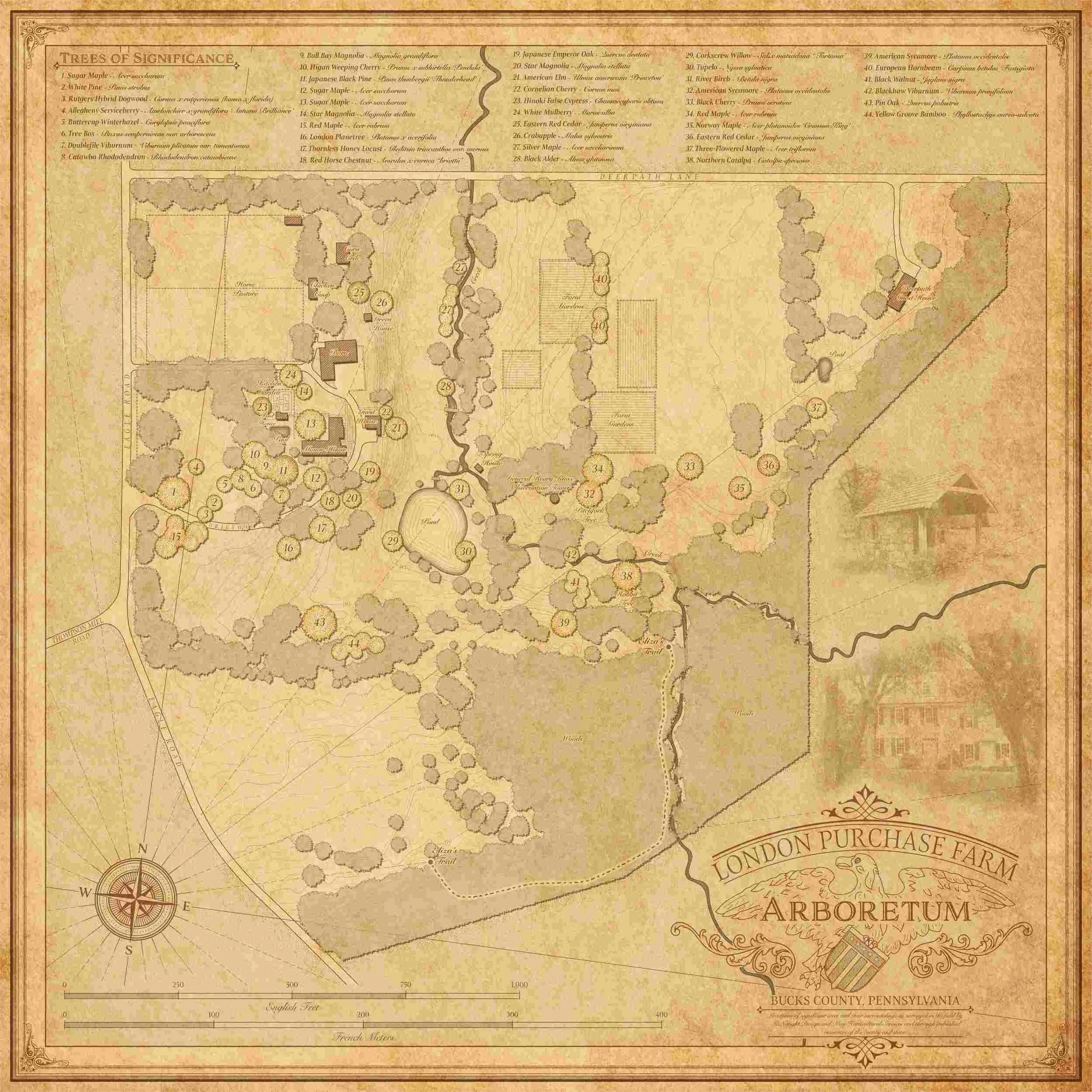
London Purchase Farm Arboretum
Creating a vintage inspired arboretum map for London Purchase Farm Arboretum in Bucks County, PA.

Rittenhouse Hill Apartments
Highlighting the new outdoor amenities at Rittenhouse Hill in Philadelphia.
Elevating Conservation Through Design
Trusted By


and more…

Behind the Maps
Evan McNaught, RLA
Evan founded McNaught Design to support outdoor recreation nationwide and to demonstrate the power of compelling visuals in inspiring a deeper appreciation for nature. After years designing public parks across the country with OLIN in Philadelphia, he recognized the vital role that great graphics, beautiful imagery, and detailed maps play in shaping how people experience and connect with the outdoors.
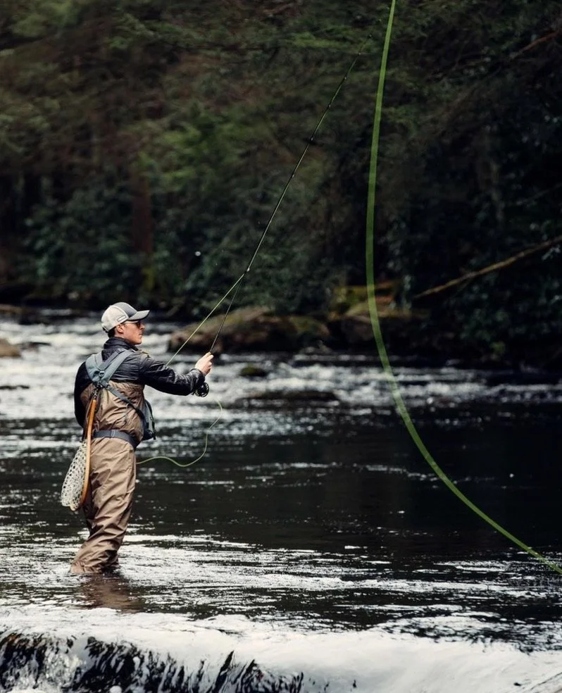
Evan is a licensed landscape architect, cartographer, and FAA Part 107 drone pilot. He brings his unique background of horticulture, design, conservation, and technology to every project. When he is not working, he loves backpacking, fly fishing, snowboarding, and gardening.

What Our Clients Say About Us
-
![Post Brothers image]()
"A pleasure to work with."
My marketing team needed some select drone shots of a property in a pinch, and I'm so glad that Evan was referred to us. Not only did he produce beautiful work, but his delivery was incredibly fast. He was such a pleasure to work with—if you need drone photos and video footage...he's your guy.
Krista Arnold - Post Brothers
-
![Landscape image]()
"McNaught design provided critical support."
Recently completed a project for a client on an historic location in Bucks County, PA. McNaught design provided critical support & logistics for our project - drone photography & GPS mapping for our arboretum project led to a wildly successful website & graphic representation of this unique property. As contractors, we could not be more pleased with the level of communication and timely execution for this project collaboration.
Christopher May - May Horticultural Services Inc.
-
![Drone image of basketball field]()
"Revealed new and fresh perspectives."
Evan produced extraordinary imagery for our Bethune and Locke Schoolyard projects. His skill and abilities revealed new and fresh perspectives that made the projects feel even more extraordinary. He is an absolute joy to work with!
Demetrios Staurinos - OLIN
-
![Drone image]()
"Has a special talent for calm problem-solving and creative solutions."
Working with Evan and McNaught Design is a true pleasure. He is creative and driven in his work and has a special talent for calm problem-solving and creative solutions. We always enjoy working with McNaught Design and looking forward to many more years of collaboration.
Kate Lawler - OLIN
-
![Forrest image]()
"An experienced professional; one stop shop on every front."
Evan at McNaught Design is one of the most professional and knowledgeable creatives I've ever worked with. His passion for the natural world, comes through in every piece he creates. The creative vision he has is only amplified by his skills and abilities as a licensed drone pilot. and When working with Evan I knew I was hiring an experienced professional; one stop shop on every front! I would recommend McNaught Design to anyone looking for a beautiful custom map or ancillary drone services, you wont regret it!
James Bonanno - JB Films


Blog
Take a look behind the scenes for new workflows, tutorials, and articles on cartography, outdoor graphics, and conservation.

Contact us
Your Experts in Custom Map Design, Outdoor Graphics, & Drone Services
Whether you need cartography, graphic design, 3D modeling, or drone services, we are ready to support you with custom solutions that meet your needs.
Let’s discuss your project today!