

Marin Water - Mt. Tamalpais Watershed Visitor Map Redesign
The Mount Tamalpais Watershed is a stunning 18,000-acre natural preserve located in Marin County, California, just north of San Francisco. This popular outdoor destination features more than 150 miles of hiking and equestrian trails, dramatic ridgelines, rolling hills, serene lakes, and shaded canyons. The watershed is home to Alpine Lake, Kent Lake, Bon Tempe Lake, and Lake Lagunitas, and is visited by thousands of outdoor enthusiasts every week.
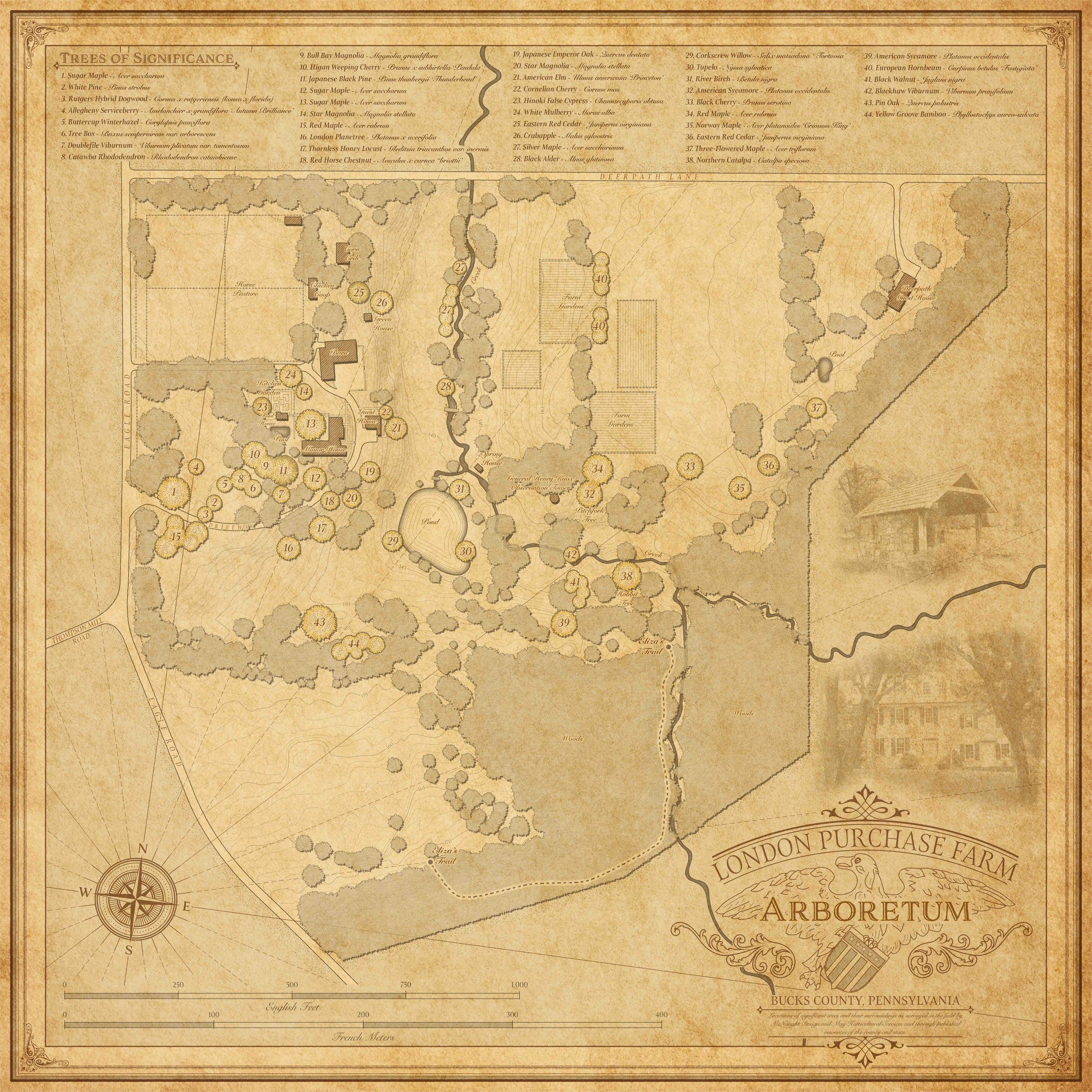
London Purchase Farm Arboretum - Map Design & Drone Imagery
London Purchase Farm is a historic estate in Bucks County with deep roots in American history—once surveyed by George Washington and now home to a breathtaking private arboretum of rare specimen trees. When the owners wanted to enhance the experience for guests and preserve the beauty of the landscape, they turned to McNaught Design for our combined expertise in custom cartography and drone services in Philadelphia.